Offshore Engineer – Ocean Geophysics Sets Up New UXO Clearance Service for Dutch Offshore Wind
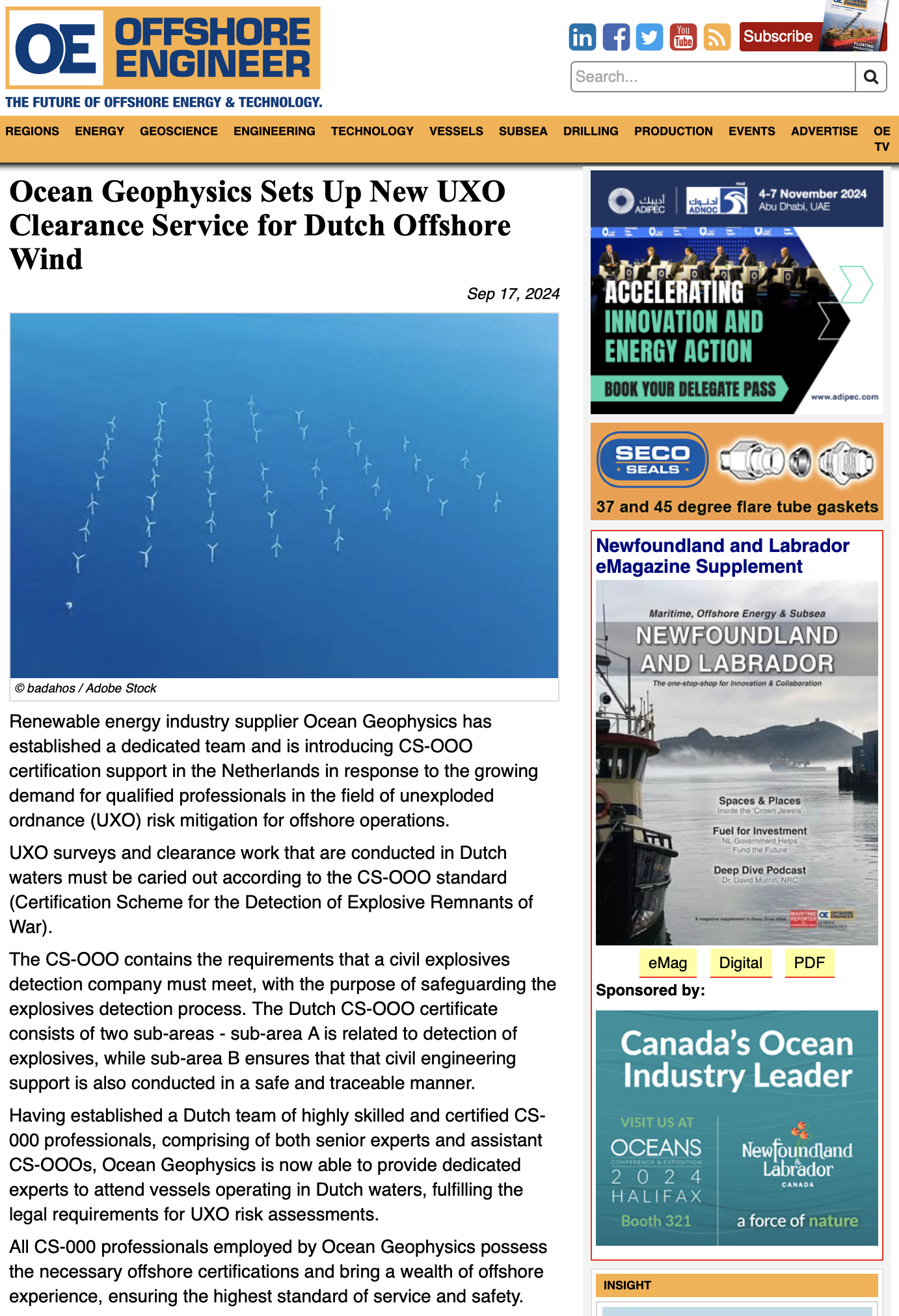
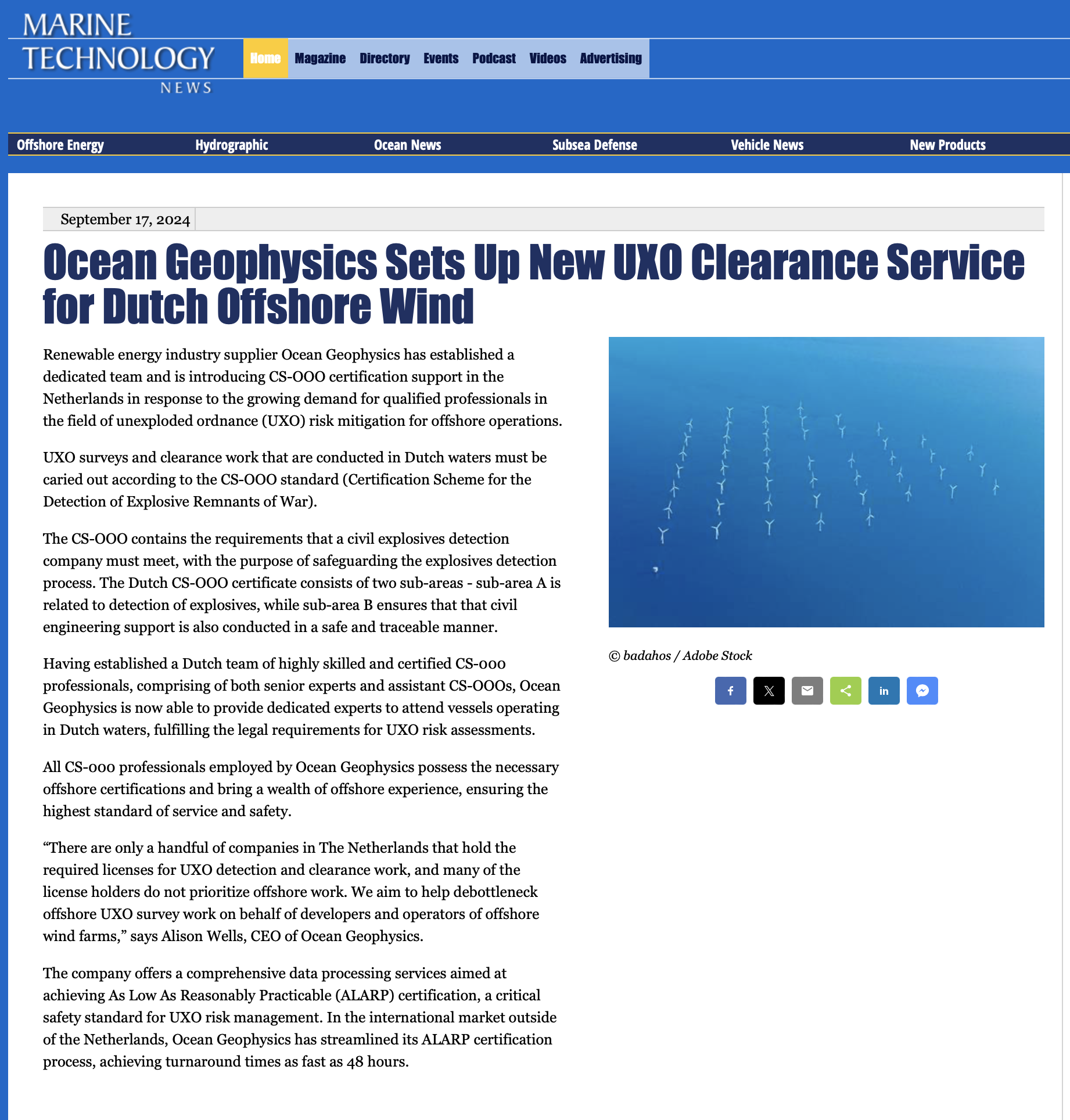
Sep 17, 2024 Renewable energy industry supplier Ocean Geophysics has established a dedicated team and is introducing CS-OOO certification support
As a remote geophysical data processing company with a dedicated team of over 50 in-house geophysicists, we possess the expertise and experience to handle your data processing needs. We specialise in supporting survey companies worldwide, offering comprehensive data acquisition support and real-time vessel support services. By entrusting us with your data processing, you can expect accurate and reliable results delivered efficiently and on time. Our commitment to excellence, combined with our cutting-edge technology and industry-leading expertise, ensures that your data is processed with the utmost precision and attention to detail.
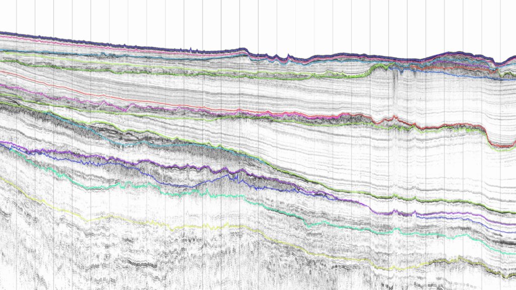
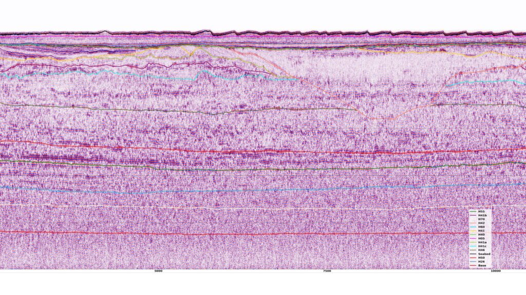
Ocean Geophysics, leading experts in multi-channel seismic, Ultra High Resolution (UHR), UHRS, 2D UHRS, and 3D UHRS data processing, is the definitive choice for unravelling complex geospatial data.
Our robust data analysis solutions harness the power of cutting-edge technologies to transform seismic data into actionable insights. We offer comprehensive UHR, UHRS, 2D UHRS, and 3D UHRS processing, boasting an unmatched capability to interpret intricate seismic signatures.
Our seasoned team distinguishes us, blending rich experience with fresh innovation. Our team has a proven track record of successfully delivering accurate subsurface imaging across a spectrum of challenging geological environments.
At Ocean Geophysics, we utilize high-performance computing and state-of-the-art workflows to produce high-resolution seismic data.
Quality, speed, and precision are hallmarks of our services. Our meticulous quality control procedures, advanced noise attenuation techniques, and bespoke processing workflows ensure the reliability and applicability of our data outputs.
We stand at the forefront of sustainable geospatial analysis with a commitment to upholding global sustainability standards.
Our dedication to fostering lasting partnerships is a cornerstone of our approach. With round-the-clock support and tailor-made services designed to meet your unique project requirements, every collaboration with Ocean Geophysics guarantees success.
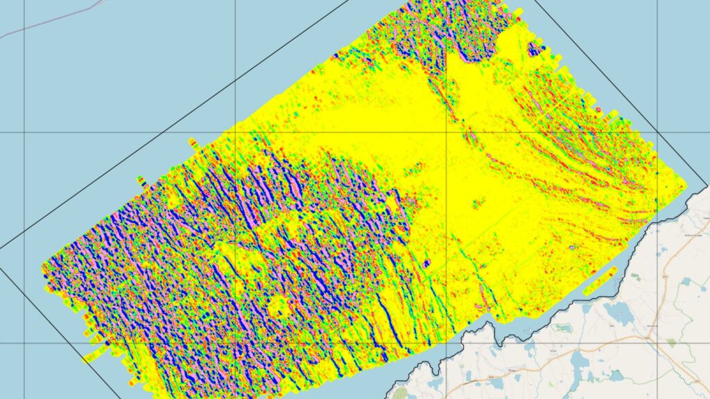
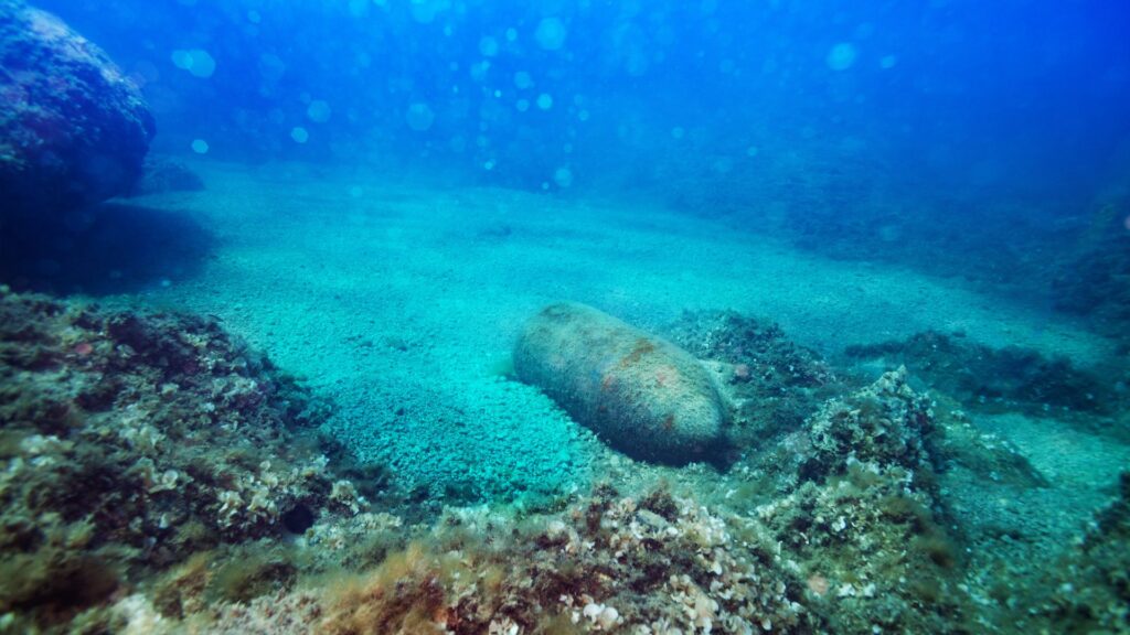
Our senior staff possess decades of experience in UXO surveys, stretching back to the first UXO surveys involving multi-magnetometer arrays. Continued project experience using vertical gradiometers, marine and terrestrial EM systems and aerial magnetometer arrays has ensured that we have kept magnetics and CSEM data processing at the forefront.
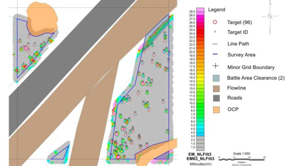
Our in-house data analysis and interpretation packages automate processes prone to human error while ensuring human QC for each magnetic contact. At Ocean Geophysics, we utilise bespoke workflows and proprietary software to produce high-resolution, diurnally corrected, regional total magnetic field maps from UXO survey data; a valuable addition to any ground model.
Ocean Geophysics possess ALARP insurance and has demonstrated the ability to provide ALARP certificates on tight turnaround times to several European clients.
Discover the unmatched expertise of Ocean Geophysics, a leading remote data processing company specialising in Unexploded Ordnance (UXO) and magnetics data analysis. With a formidable senior team of industry experts, we excel in processing complex data, often handling cases that challenge the rest of the industry.
Our track record in UXO analysis is outstanding, effectively addressing the hidden dangers posed by these remnants of conflicts past. Leveraging industry-leading software packages such as Oasis Montaj and Moga Seaview and our in-house Ocean Sweets, we efficiently interpret magnetic anomalies, identifying potential UXO risks with precision and speed.
Each project we undertake is approached with meticulous attention to detail. Our thorough data processing ensures the identification and mitigation of UXO threats to As Low As Reasonably Practicable (ALARP) standards, facilitating safe and efficient operations for your projects.
At Ocean Geophysics, we don’t shy away from complexity. In fact, we embrace it. Our reputation as the go-to team for complex cases demonstrates our ability to resolve issues that others cannot. The more intricate the data, the more we thrive.
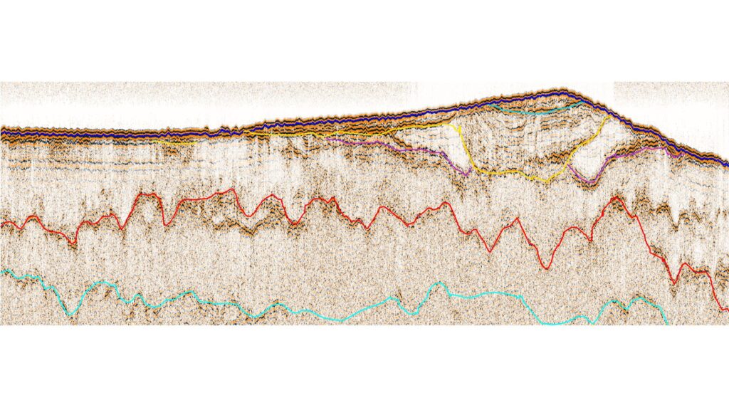
Join Ocean Geophysics, the industry’s leading expert in Sub-Bottom Profiler (SBP) and single-channel seismic data analysis, for top-tier remote geospatial data processing services.
Our speciality lies in processing SBP data, providing detailed imagery of the subsurface structure beneath the seabed. Using industry-leading software packages such as Kingdom and DUG Insight, we deliver high-resolution, accurate, and insightful data, supporting your marine geophysical investigations and offshore developments.
Our expert team combines industry veterans and innovative thinkers to address even the most complex single-channel seismic data challenges. Leveraging state-of-the-art artificial intelligence and high-performance computing, we ensure efficient, speedy, and precise analysis, enabling you to make informed decisions faster.
At Ocean Geophysics, we are dedicated to quality assurance. Rigorous checks and advanced noise reduction techniques guarantee that our data is not only reliable but actionable.
We believe in bespoke solutions to cater to the unique requirements of your project. Whether you’re conducting geological mapping, hydrocarbon exploration, or marine site surveys, we tailor our approach to deliver optimum results.
Our commitment extends beyond data processing to building strong, lasting partnerships. With round-the-clock support, transparent communication, and tailored services, we strive to make every collaboration a successful and satisfying experience.
Additionally, we align our services with global sustainability standards, ensuring that your exploration activities contribute positively to environmental stewardship.
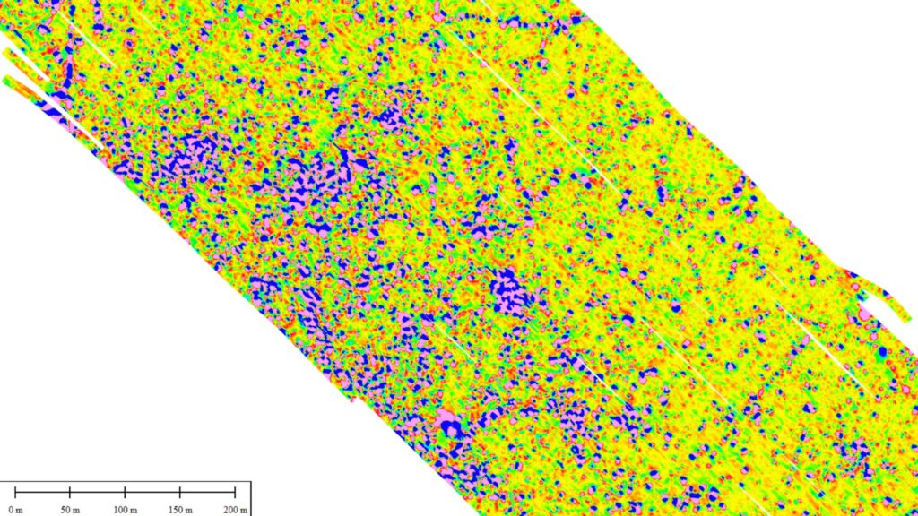
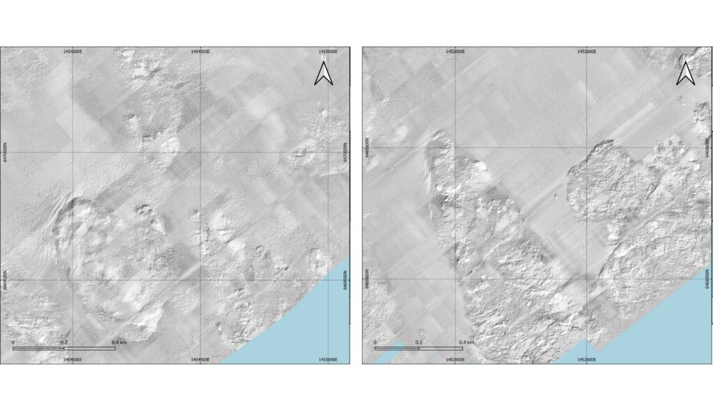
Join forces with Ocean Geophysics, the industry’s premier expert in high and low-frequency side scan sonar (SSS) data processing. As remote geospatial data processing specialists, we excel in tackling the most challenging SSS data, providing you with detailed and actionable insights into marine environments.
Our team utilises both high and low-frequency side scan sonar technology, offering a wider range of sub-seabed visibility and enhanced data resolution. By integrating industry-standard programs with our custom-developed scripts, we provide bespoke data processing solutions tailored to your unique project requirements.
Our superior technical prowess in SSS data processing is amplified by our use of cutting-edge technical knowhow and high-performance computing capabilities. This combination not only accelerates our data processing pipelines but also ensures unparalleled accuracy and efficiency.
Quality assurance is at the heart of our services. We employ rigorous quality control measures and sophisticated noise reduction techniques, guaranteeing that the data you receive is reliable, accurate, and ready to inform your decision-making.
At Ocean Geophysics, we are more than just a service provider; we are a committed partner to your success. Our dedicated round-the-clock support and transparent communication promise a seamless collaborative experience.
We firmly adhere to global sustainability standards, reflecting our commitment to responsible and environmentally conscious marine exploration. With Ocean Geophysics, you can be confident that your exploration objectives align with environmental stewardship.
Join Ocean Geophysics and let’s navigate the future of marine geospatial analysis together. Our high-quality, sustainable, and customisable side scan sonar solutions are designed to propel your marine operations to new depths of success.
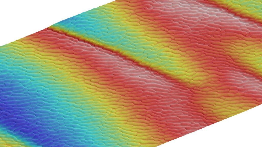
Step into the realm of Multibeam Echosounder (MBES) data processing. Our formidable team headed by Tom Lock has earned us the reputation of transforming complex MBES data into comprehensive bathymetric maps and seafloor classifications.
We utilise industry-leading software packages like AutoClean and Qimera, which allow us to perform efficient data cleaning and processing, yielding high-resolution 3D maps of the seabed. With precision and speed, we decipher MBES data, turning it into actionable geospatial insights.
Our expertise does not end with data processing; it extends to the intricate understanding of the marine environment. We believe in the power of details and accuracy, providing the highest level of data integrity in all projects.
At Ocean Geophysics, we recognise the urgency associated with your operations. That’s why we offer around-the-clock global service to ensure uninterrupted data processing, providing results when you need them most.
Ocean Geophysics are able to offer our clients ALARP certification, ensuring that UXO risks are mitigated to the lowest reasonable level. Our experienced team is dedicated to delivering meticulous approvals and is trusted by clients worldwide for their unparalleled expertise and thoroughness.
We employ state-of-the-art technologies and advanced data analysis techniques to assess and certify UXO risks accurately. Each ALARP certification project undergoes rigorous quality checks, ensuring that our recommendations are reliable, actionable, and compliant with industry standards and regulatory requirements.
We are steadfast in our commitment to safety and sustainability. Our ALARP certifications align with global sustainability standards, demonstrating our commitment to environmentally conscious UXO risk management.
We navigate the complexities of Controlled-Source Electromagnetic (CSEM) data analysis with Ocean Geophysics, the industry’s premier remote data processing company.
Excel in the processing of CSEM data, offering detailed insights into subsurface resistivity distributions, critical for hydrocarbon exploration, the initial stages of land based UXO detection and reservoir monitoring. We transform raw CSEM data into actionable geophysical intelligence.
Quality assurance is ingrained in our processes. With rigorous quality checks and advanced noise attenuation techniques, we ensure that our data is dependable, accurate, and ready to inform your exploration decisions.
Quality Assurance (QA) and Quality Control (QC) of offshore geophysical data are essential to ensure the accuracy and reliability of survey results. At Ocean Geophysics, we provide top-tier QA and QC services from our state-of-the-art onshore data centre. Due to the vast size and complexity of geophysical data sets, processing and quality control offshore pose significant challenges, primarily because of limited processing power and resources. This necessitates a robust onshore solution, which Ocean Geophysics is fully equipped to deliver.
Ocean Geophysics offers wind farm and infrastructure developers the unique opportunity to offload their internal QA/QC of contractor’s work to us. Our team possesses the expertise to perform meticulous Quality Control of survey reports and all associated data. We provide detailed comments and recommendations to enhance the quality of the final report, ensuring your data meets the highest standards of accuracy and reliability. This service is crucial for better decision-making and successful project execution.
Our onshore facilities are specifically designed to handle large data volumes efficiently, offering thorough QA and QC processes that offshore environments cannot match. With extensive experience in the offshore renewables, cables, and Oil and Gas industries, we leverage our advanced infrastructure to guarantee the integrity and precision of your geophysical data. Trust Ocean Geophysics to support your project outcomes with the highest quality standards in the industry.

In an epoch where technology has accelerated acquisition and allows critical review of contractor performance and deliverables, effective client representation is critical.
With a broad base of industry-leading professionals, Ocean Geophysics can cover the full gamut of offshore client representation requirements.
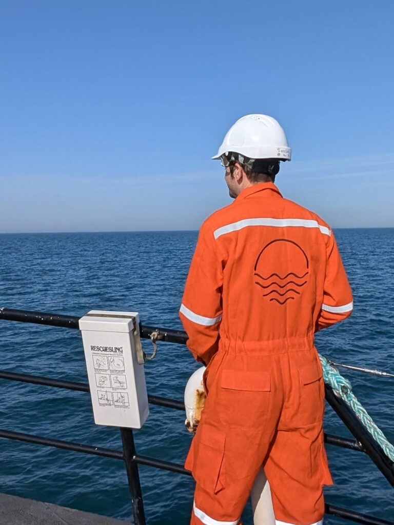
Client led service in which your confidence is assured. Deployed operatives chosen for their extensive experience are combined with the Ocean Geophysics global 24-hour support services.
A focus on QSHE performance comes as standard. Specialist QHSE representation handling document creation, review and offshore deployment are internally available. Fields of expertise include (but are not exclusive):
At Ocean Geophysics, we are excited to announce our latest service offering in the Netherlands: CS-000 certified professionals for Unexploded Ordnance (UXO) risk management. Our new business line responds to the increasing need for qualified UXO experts to ensure safe and compliant offshore operations in Dutch waters.
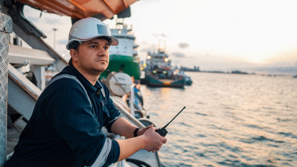
Our team of highly skilled CS-000 professionals is ready to attend vessels operating in the waters of the Netherlands, fulfilling all legal requirements for UXO risk assessments. Each member of our CS-000 team has the necessary offshore certifications and a wealth of experience, ensuring top-tier service and safety standards. Whether for dredging, construction, or other maritime activities, our experts provide the support needed to keep your operations on track and on time.
Ocean Geophysics offers more than just on-site expertise. We provide a full suite of data processing services to asist in achieving As Low As Reasonably Practicable (ALARP) certification, a critical safety standard in UXO risk management. Thanks to our efficient processes and experienced team, we can turn around ALARP certification within 48 hours, ensuring minimal delays for your projects.
Our services also include thorough desktop studies as part of the ALARP certification process. These studies are conducted by our expert analysts, providing you with a comprehensive understanding of potential UXO risks and ensuring compliance with Dutch regulations.
Offshore Engineer – Ocean Geophysics Sets Up New UXO Clearance Service for Dutch Offshore Wind
Sep 17, 2024 Renewable energy industry supplier Ocean Geophysics has established a dedicated team and is introducing CS-OOO certification support
Marine Technology News – Ocean Geophysics Sets Up New UXO Clearance Service for Dutch Offshore Wind
SEPTEMBER 17, 2024 Renewable energy industry supplier Ocean Geophysics has established a dedicated team and is introducing CS-OOO certification support
ECO Magazine – Ocean Geophysics Establishes CS-OOO Service for Dutch Offshore Wind
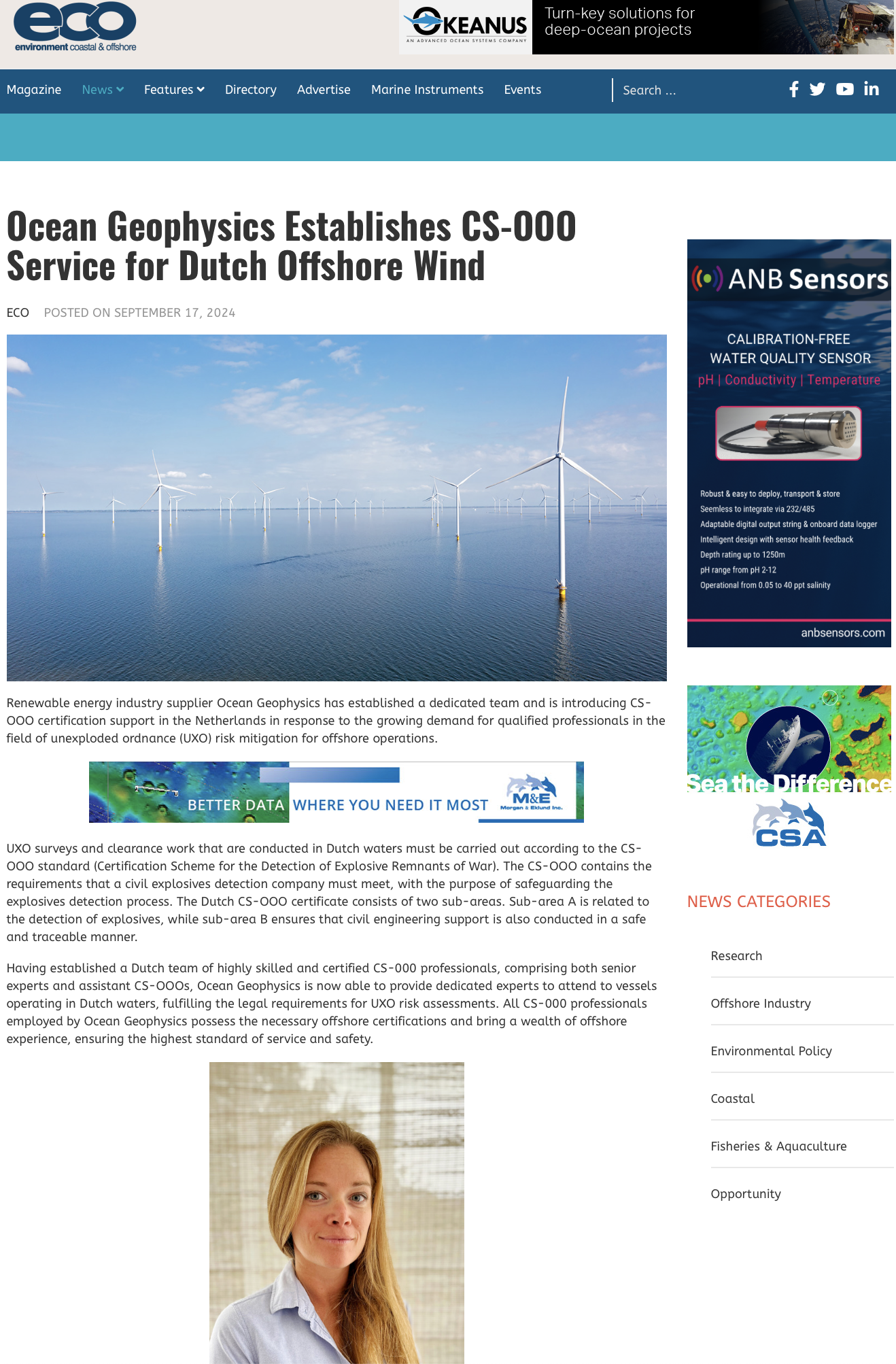
ECOPOSTED ON SEPTEMBER 17, 2024 Renewable energy industry supplier Ocean Geophysics has established a dedicated team and is introducing CS-OOO